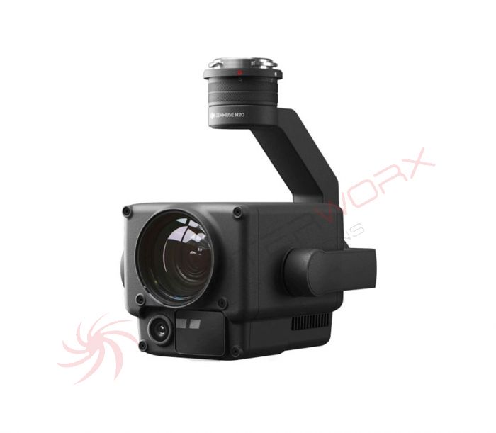
DJI Zenmuse H20
Zenmuse H20 series - Integrated maximum performance
"H" for hybrid
Multi-sensor payloads that give the efficiency of operations a whole new meaning. With unparalleled intelligence and built-in design, unprecedented aerial photography capabilities are available for a range of commercial drone applications.
12 megapixel wide angle camera
20 megapixel zoom camera
Radiometric thermal imager
Laser rangefinder
Degree of protection IP44
Operating temperature -20 ° C to 50 ° C
Active and electronic image stabilization
Night scene mode
All required sensors in one device
Record everything. Up close or from a distance. In real vivid colors or as a thermal image. An integrated laser rangefinder (LRF) measures the distance to an object up to 1,200 m away. A powerful, integrated payload that unleashes advanced intelligent features for DJI's industrial drone platforms.
H20 Triple sensor solution
20 MP zoom camera
12 MP wide angle camera
1,200 m laser rangefinder
Limitlessly precise foresight
Powerful zoom camera
23x optical hybrid zoom, 200x max. Zoom
20 megapixel 1 / 1.7 "CMOS sensor
Video resolution: 4K at 30fps
Everything in view
Wide angle camera
35 mm equivalent focal length: 24 mm 82.9 °
12 megapixels 1 / 2.3? CMOS sensor
Precise distance data
Laser rangefinder
Range: 3 m? 1,200 m
Accuracy: ± (0.2 m + D × 0.15%)
Discover the invisible
Radiometric thermal imager
DFOV: 40.6 °
Resolution: 640 × 512 pixels, frame rate: 30 fps
Heat sensitivity: = 50 mk at f / 1.0 (NEDT)
One for everything
Multi-sensor payloads
See the whole picture without missing any details wherever your assignment takes place.
Seamless user interface
With a new integrated user interface, you can quickly switch between wide-angle, zoom and thermal imager and preview the zoom field of view (FOV) in the wide-angle or thermal imager view.
Intelligent data collection options
AI job review
Automate routine inspections and capture consistent results every time. The AI recognizes the pre-marked object and thus enables consistent recording in regular and automated operations.
High resolution raster photo
Mark a desired area in a large-scale camera view and the zoom camera automatically takes a series of pictures with 20 megapixels per picture of this area. These images are saved together with an overview image and thus enable a more detailed view.
PinPoint (precise location)
You can quickly mark a visible object and advanced sensor fusion algorithms immediately deliver its coordinates.
Persecution
Identify and track moving subjects such as people, vehicles, and boats with the auto-zoom feature while continuously capturing the dynamic location of the subject.
Visualize temperatures immediately
Precise temperature measurement
To avoid risk, you can monitor the temperature of a location or object by determining an accurate temperature value from the air.
Point measurement
Mark a point to read the surface temperature in real time.
Area measurement
Select an area to view its minimum, maximum and average temperature.
Intelligent functions
Temperature alarm
You will receive instant notifications in DJI Pilot if an object exceeds predetermined temperature thresholds.
isotherm
The visualization of a certain temperature band helps to recognize the essentials.
Color palettes
The colors in which the thermal image data are mapped can be adjusted depending on the requirements of certain scenarios.
Gain modes
The temperature range to be recorded can be changed by setting the amplification modes: With high amplification, a smaller temperature range is covered, but is more sensitive to temperature differences; however, a lower temperature range covers a larger temperature range.
R-JPEG images
The pictures taken with the Zenmuse H20T are saved in R-JPEG format with embedded temperature data. By importing these images into the thermal imaging analysis tool from DJI, temperatures can be measured and parameters such as emissivity and reflected temperature can be adjusted.
The ideal addition for the Matrice 300 RTK
Applications
Firefighting
Extinguish fires and save lives without endangering people
Rescue operations
React quickly to locate missing people and thus better plan rescue operations.
Prosecution
Can quickly assess the situation and react accordingly - at the same time improve the safety of emergency services and passers-by.
Inspections of high-voltage lines
Visualize large-scale networks of high-voltage power lines comfortably - even in remote areas.
Oil and gas supply
Inspect pipelines or boreholes without employees having to go to dangerous locations.

